1. Introduction
The International Association of Geodesy (IAG) Special Study Group (SSG) 3.163 was established during the XXI General Assembly of the International Union of Geodesy and Geophysics (IUGG) held in Boulder, Colorado in 1995. The SSG 3.163 was composed of the 20 members and 6 corresponding members. This report outlines the SSG activities and some of the progress that has been made in this area during the period 1995-99. A SSG-3.163 page was establised (address: http://sg.topo.auth.gr/~arab/Miscellaneous/ssg3163.html) in order to share information, software and data to the members of the SSG.
2. Objectives
The main objective of the SSG are as follows:
Members: D. Arabelos (Greece, Chairman), R. Barzaghi (Italy), P. Berry (UK), H. Denker (Germany), S. Ekholm (Denmark), Y. Fukuda (Japan), Ch. Green (UK), R. Haagmans (The Netherlands), A M. Hittelman (U.S.A.), W. Kearsley (Australia), S. Kenyon (U.S.A.), P. Knudsen (Denmark), Li Li (China), R. Salman (U.S.A.), D. Sandwell (USA), G. Sarrailh (France), H.-W. Schenke (Germany), H. SŸnkel (Austria), C. C. Tscherning (Denmark), Gwo-Chyang Tsuei (Republic of China), I.N. Tziavos (Greece)
Corresponding members: Mustapha Bouziane (Algeria), Rene Forsberg (Denmark), Scott Luthcke (USA), Nikos Pavlis (USA), Michael G Sideris (Canada), Klaus-Peter Schwarz (Canada), Martin Vermeer (Finland), H.-G. Wenzel (Germany)
4. Meetings
A business meeting was held in Rio de Janeiro, Sept. 5, 1997 during the IAG Scientific Assembly in Rio de Janeiro, September 3-9, 1997.
In the frame of the EGS XXIV General Assembly, a session was organized, entitled "Topography and Bathymetry in Geodetic and Geophysical Applications".
5. Summary of activities
5.1.New developments
NASA/GSFC-NIMA:
The global 5' elevation model JGP95E was made available to the members of the SSG by S. Kenyon and N. Pavlis. According to S. Kenyon, the updating of the model with new DTED is continued.
GETECH (Reported by Chris Green ):
i. For Central and South America: 3' ´
3' digital terrain model (DTM3)
ii. For Europe: 2.5'´ 2.5' digital terrain model (DTM2.5)
iii. 5'´ 5' DTM of the
world (DTM5).
NGDC (Reported by Allan Hittelman)
The new global 30' DEM called GLOBE was recently released
via the Web. David Hastings, a senior scientist in NOAA, chaired the international
effort that developed this compilation. The relevant site at: http://www.ngdc.noaa.gov/seg/topo/globe.shtml
is rich with numerous download options, documentation and images. A paper
on this effort will be presented by A. Hittelman at the IUGG 99 (Symposium
G3).
Hughes STX (Reported by N. Pavlis on behalf of Anita
Brenner and Scott Luthcke)
i. Exploitation of satellite altimetry is to create digital
elevation models of the polar ice sheets and land. 10 km digital elevations
models of both Greenland and Antarctic ice sheets to 81.5o latitude
will shortly be available on CD-ROM from the National Snow and Ice Data
Center. A 15’ DEM of South America using ERS-1 Geodetic Mission Data has
been created.
ii. Satellite laser altimetry for ice sheets and land
topography
5.2. Intercomparison of the global DTMs ETOPO5, TerrainBase and JGP95E
During the business meeting in Rio de Janeiro R.-H. Rapp suggested the assessment of the global DTMs through inter comparison of them. From the inter comparison, the following conclusions could be drawn (Arabelos, 1999):
The standard deviation of the differences between the three models (90 m, 112 m and 92 m) is of the order of 100 m. Taking into account that 60% of the data (the oceanographic data), are common for the three models, we must assume that the discrepancies of the continental data resulting in standard deviation higher than 100 m.
As it was expected, the larger discrepancies were observed in areas with data characterized by poor quality and coverage (Africa, Central Asia). In areas covered with good quality data (USA, West Europe, Australia, Japan, Corea) the convergence of the models is remarkable.
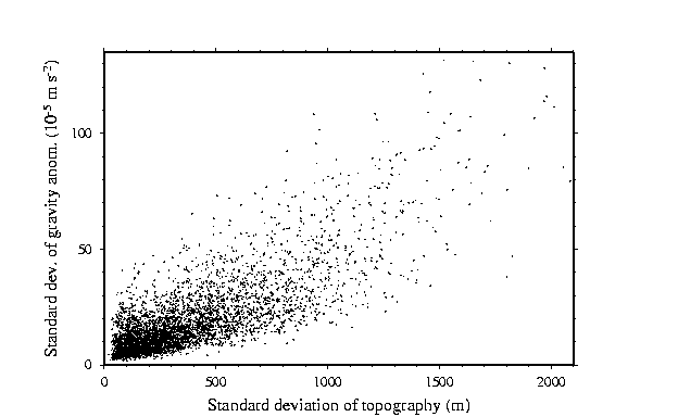
The standard deviation of the differences between topographic corrections of gravity anomalies due to the differences between the three DTMs varies in Central Africa from 6 to 9 mGal, with min and max values ranging from -119 to 87 mGal.
The reliability of the oceanographic data must be considered as comparable with that of the continental data. The fact that the three models include the same data in the oceanic areas (that of ETOPO5) and the lack of reliable oceanographic data, makes the assessment impossible without taking into account the quality information of the very original oceanographic measurements.
The quality of the models considered does not correspond to the recent requirements, for geodetic and other applications. On the other hand, the resolution of the 5' is very sufficient and necessary for many applications. Therefore, significant improvements are necessary in order to be created a reliable DTM with the same accuracy for all areas around the earth, proper for regional and global geodetic, geophysical and oceanographic applications.
The differences between the three models were visualized in 20o ´ 30o blocks. These figures are available through the home page of the SSG-3.163
(http://sg.topo.auth.gr/~arab/SSGJPEG/hague992.html).
5.3. Spherical harmonic expansions
Ultra high degree spherical harmonic models of the Earth's topography, rock equivalent topography and topographic isostatic potential were developed by H.-G. Wenzel (personal communication, 1998) This development to degree 1800, was based on the global elevation model ETOPO5. Two major points should be discussed in the next:
Satellite Altimetry from ERS-1, and ERS-2 Geodetic Mission has been used in an intensive attempt to create/improve DTMs of both the Greenland and Antarctic ice sheets as well on land. The accuracy of the models based only on satellite altimeter data over the ice sheet varies from several tens meters to several hundreds meters, depending of the slop of the surface. Better results were achieved by combining a variety of digital elevation data (e.g. Ekholm, 1996).
The current accuracy estimates of the shuttle laser altimeter for low slope terrain are of the order of 1.5 to 3.0 m.(S.Luthcke)
Intensive studies on the possibility to obtain globally topography from land altimeter data showed that it is possible to improve on the topographic knowledge of the continents at least for those regions where poor elevation data currently exists (e.g. Brenner et al., 1997, Berry 1999).
5.5. Ground and space techniques for the improvement of ocean bottom topography
Satellite altimetry has earlier been recognized as a source of information that can provide valuable information about the bathymetry. Simultaneously with the method applied by Smith and Sandwell (1994) for the bathymetric prediction from dense satellite altimetry and sparse shipboard bathymetry, least squares collocation was used for the inversion of gravity data (Barzaghi et al. 1992, Knudsen 1993). The gravity data can be observed or predicted gravity anomalies from altimeter data in areas with poor coverage with observed gravity data. Taking advantage of the flexibility of this method, Tscherning et al. (1994) performed an experiment to estimate the bottom topography in a test area in the Mediterranean by inverting gravity data. The method was further used in global (Knudsen and Andersen, 1996) or regional experiments (Arabelos, 1997; Arabelos and Tziavos, 1998). These experiments showed that the isostatic compensation of the topography, mainly at the crust/mantle interface is important to consider. The comparison between bathymetric models derived by inverting gravity data with "observed" bathymetric maps showed that the main features of the see floor are clearly described by the predicted bathymetric models. Experiments using the estimated bottom topography to smooth data related to gravity field (through e.g. RTM reductions) showed that generally the estimated bottom topography gives better results that the "observed" bathymetric models. The estimated bottom topography could be used in gravity field modeling and in other applications in areas where no high quality observed depths of the sea floor are available.
Finally, intensive experiments using SAR interferometry are described in the recent literature. Using improved techniques and exploiting all the available information, InSAR is a very promising tool for the improvement of DEMs (e.g., Rocca et al., 1997; Tscherning 1997).
SSG-3.163 Literature
Anzidei, M.: Rapid bathymetric survey and DTM of the Panarea caldera (Aeolian Islands, Southern Tyrrhenian Sea). Presented at the 24th General Assembly of the EGS, The Hague, 19-23 April, 1999.
Arabelos, D.: Validation of ETOPO5U in the Hellenic area. Bull. Geod 68, 88-99, 1994.
Arabelos, D., I.N. Tziavos: Comparisons of the global ETOPO5U model with local DTMs. Proceedings INSMAP94, pp 132-141, 1994.
Arabelos, D.: On the possibility to estimate ocean bottom topography from marine gravity and satellite altimeter data: using collocation. IAG Symposia, Vol. 119, pp 105-112, 1997.
Arabelos, D., I.N. Tziavos: Gravity field improvement in the Mediterranean Sea by estimating the bottom topography using collocation. Journal of Geodesy, 72, 136-143, 1998.
Arabelos, D.: Intercomparisons of the global DTMs ETOPO5, TerrainBase and JGP95E. Presented at the EGS XXIV General Assembly, The Hague, April 18-23, 1999.
Bamber, J., Muller., J.P., Mandanayake., A., "A Global 5 arc minute Digital Elevation Model derived From The Geodetic Phase Of ERS-1" Proc. 3rd ERS Symp. On Space at the service of our environment, Florence, March 1997.
Barzaghi, R., F. Sanso and C. Zenucchini: The collocation approach to the inversion of gravity data. Geophysical Prospecting, Vol. 40, 429-452, 1992.
Berry, P.A.M., M. Leigh: Towards validation and correction of global digital elevetion models with ERS-1 Altimetry. Proc. 3rd ERS Symp. on Space at the service of our Enviroment, Florence, Italy, 17-21 March 1997 (ESA SP-414, 3 Vols., May 1997.
Berry, P.A.M., R.F. Sanders, C. Leemans and E. Born: Generating Orthometric Heights from the ERS-1 Altimeter Geodetic Mission Dataset: Results from an Experts Systems Approach. IAG Symposia, Vol. 119, pp 113-118, 1997
Berry, P.A.M., R.A. Pinnock and J.I. Hoogerboorn: Land calibration of radar altimeter sigmao. Presented at the EGS XXIV General Assembly, The Hague, April 18-23, 1999.
Berry, P.A.M., Bron, E., Sanders, R.F. & Leenmans, C., "Use of ERS-1 Land Altimetry to Validate the GLOBE Global Digital Elevation Model", IAG Symposium, Rio de Janeiro, September 1997.
Berry, P.A.M., Sanders, R.F., Leenmans, C. & Bron, E. "Generating Orthometric Heights From The ERS-1 Altimeter Geodetic Mission Dataset: Results From An Expert Systems Approach", IAG Symposium, Rio de Janeiro, September 1997.
Berry, P.A.M., Dowson, M. "Potential Of ERS-1 Derived Orthometric Heights To Generate Ground Control Points" Proc. 3rd ERS Symp. On Space at the service of our environment, Florence, March 1997.
Berry, P.A.M., Bracke, H., Jasper, A. "Retracking ERS-1 Altimeter Waveforms Over Land For Topographic Height Determination: An Expert Systems Approach" Proc. 3rd ERS Symp. On Space at the service of our environment, Florence, March 1997.
Berry, P.A.M., "Topography from land altimeter data: possibilities and restrictions". Presented at the EGS XXIV General Assembly, The Hague, April 18-23, 1999.
Berry, P.A.M., Hoogerboord, J.E. & Pinnock R.A., "Identification of Common Error Signatures In Global Digital Elevation Models". Presented at the EGS XXIV General Assembly, The Hague, April 18-23, 1999.
?racke, H., Berry, P.A.M. & Dowson, M., "Geodetic Applications of ERS-1 Altimeter Data Over Land" American Geophysical Union Fall Meeting, December 1996.
Brenner, A.C., R.A. Bindschadler, R.H. Thomas, H.J. Zwally: Slope-Induced Errors in Radar Altimetry Over Continental Ice Sheets. Journal of Geophysical Res., Vol. 88, 1983.
Brenner,A.C., H. Frey, J. DiMarzio, and L. Tsaoussi, "Topography over South America from ERS Altimetry". Proc. 3rd ERS Symp. on Space at the service of our Enviroment, Florence, Italy, 17-21 March 1997 (ESA SP-414, 3 Vols., May 1997).
?ron, E.I., "Global DEM Comparison - A comparison between satellite altimeter data and the GLOBE dataset" Dissertation for M.Sc. Informatics, Leicester, August 1997
Carasco, D., Broquetas, D. & A., Arbiol, R., Castillo, M., Pola, V., "Ascending-descending orbit combination SAR interferometry assesment" Proc. 3rd ERS Symp. On Space at the service of our environment, Florence, March 1997.
Cornet, Y., Dulliez, J.-Y., Moxhet, J., Closson, D., Kourgli, A., Ozer, P., Ozer, A., Derauw, D., "Use of ERS Tandem data to produce Digital Elevation Models by inetrferometry and study land movements by differential Inreferomtetry in Calabria and Jordan" Proc. 3rd ERS Symp. On Space at the service of our environment, Florence, March 1997.
Constantini, M., "Validation of a novel phase unwrapp algorithm using true and simulated ERS tandem SAR interferometric data" Proc. 3rd ERS Symp. On Space at the service of our environment, Florence, March 1997.
Cumming, I., Xu, W., "Comparison of phase unwrapping performance using a noisy interferogram" Proc. 3rd ERS Symp. On Space at the service of our environment, Florence, March 1997.
Davis, C.H. C.A. Cluever, and B.J. Haines: Elevation Change of the Southern Greenland Ice Sheet. Science, Vol. 279, 1998.
Davis, C.H. and H.J. Zwally: Geographic and Seasonal Variations in the Surface Properties of the Ice Sheets by Satellite Radar Altimetry. Journal of Glaciology, Vol. 39, 1993.
Dixon, T.H., M. Naraghi, M.K. McNutt and S.M. Smith: Bathymetry prediction from SEASAT altimeter data. J. Geoph. Res. 88, 1563-1571, 1983.
Dowson, M. and P.A.M. Berry: Geodetic application of ERS-1 altimeter data over land. IAG Symposia, Vol. 119, pp 125-131, 1997
Dowson, M. and P.A.M. Berry:Global precision estimate of radar altimetry heighting over land. Presented at the EGS XXIV General Assembly, The Hague, April 18-23, 1999.
Doyle, F., "Thirty years of mapping from space" International Archives of Photogrammetry and Remote Sensing, Vol. XXXI, Vienna 1996
Dupont, S., Nomin, P., Remouard, L., Pichon, G., Bignone, F., "Atmospheric artifacts in ERS-DTM Istars experience over multiple sites and large areas" Proc. 3rd ERS Symp. On Space at the service of our environment, Florence, March 1997.
Ekholm, S.: A full coverage, high-resolution topographic model of Greenland computed from a variety of digital elevation data, J. Geophys. Res., 101, B10, 21,961-21,972, 1996.
Ekholm, S. and J.L. Bamber: A new, full coverage , topographic model of Greenland computed from Geodetic Mission radar altimetry, digital acrophotogrametry and other elevation information. Presented at the EGS XXIV General Assembly, The Hague, April 18-23, 1999.
Ferreti, A., Prati, C., Rocca, F., Guarnieri, M., "Multibaseline SAR Interferometry for Automatic DEM Reconstruction" Proc. 3rd ERS Symp. On Space at the service of our environment, Florence, March 1997.
Frey, H. and A. C. Brenner, Australian Topography from Seasat Overland Altimetry, Geophysical Research Letters, Vol. 17, No. 10, pp1533-1536, (Sep 1990).
Goze, S., Blanc, F., Planes, J.G., Piau, P., Sylvander, S., Xavier, J.P., "Three dimensional exploitation of tandem imagery acquireed with Libreville mobile station" Proc. 3rd ERS Symp. On Space at the service of our environment, Florence, March 1997.
Hittelman, A. M.: Gravity Earth System Data, NOAA, Alpha release, March 1992.
Huess, V. and O. Andersen: Near coastal altimetry in the Eastern North Sea. Presented at the EGS XXIV General Assembly, The Hague, April 18-23, 1999.
Knudsen, P.: Integrated inversion of gravity data. Final Report Norsk Hydro R&D Project, Kort og Matrikelstyrelsen, Geodetic Division, Technical Report No. 7, Copenhagen, 1993.
Knudsen, P. & O. Ba. Andersen: Ocean bottom topography from ERS-1 altimeter data. Earth Observation Quarterly, No. 51, pp. 16-18, 1996.
Lebertl, F., "The applicability of Satellite Remote Sensing to small and medium Scale Mapping" Proc., of an EARSel-ESA Symposium, Austria, April 1982
Lemoine F.G., Kenyon, S.C., Factor, J.K., Trimmer, R.G., Pavlis, N.K., Chinn, D.S., Cox, C.M., Klosko, S.M., Luthcke, S.B., Torrence, M.H., Wang, Y.M., Williamson, R.G., Pavlis, E.C., Rapp, R.H., Olson, T.R.: The development of the joint NASA GSFC and the National Imagery and Mapping Agency (NIMA) Geopotential Model EGM96. NASA/TP-1998-206861, !998.
Light., D., "Characteristics of Remote Sensors For Mapping and Earth Science Applications" Photogrammetric Engineering & Remote Sensing, Vol. 36, December 1990
Lingle, C.S., L.-h. Lee, H.J. Zwally and T.C. Seiss: Recent Elevation Increase on Lambert Glacier, Antarctica, From Orbit Crossover Analysis of Satellite Radar Altimetry. Annals of Glaciology, 20, 1994.
Martin, T.V.,H.J. Zwally,A.C. Brenner, and R.A. Bindschadler: Analysis and Retracking of Continental Ice Sheet Radar Altimeter Waveforms. J. Geophys. Res.,88, C3, 1983.
Nielsen, C.S., Forsberg, R., Ekholm, S., Mohr, J.J., "Merging of Elevations from SAR Interferometry, Satellite Altimetry, GPS and Laser Altimetry in Greenland" Proc. 3rd ERS Symp. On Space at the service of our environment, Florence, March 1997.
Nuth et al.:The application of radar altimeter to the problem of ice sheer thickness changes. Presented at the EGS XXIV General Assembly, The Hague, April 18-23, 1999.
Parsons, C.L: An Assessment of GEOS-3 Waveheight Measurements. Ocean Wave Climate, edited by M.D. Earle and A. Malahoff, Plenum, New York, 1979.
Rocca, R., C. Prati, A. Ferreti: An overview of ERS-SAR interferometry. Proc. 3rd ERS Symp. on Space at the service of our Enviroment, Florence, Italy, 17-21 March 1997 (ESA SP-414, 3 Vols., May 1997).
Sanchez, J.I., Laur, H., "The ERS-SAR performances, products, and systems" Proc. 3rd ERS Symp. On Space at the service of our environment, Florence, March 1997.
Seymour, M., Cumming, I., "Improving DEMS using SAR Interferometry" Proc. Int. Geoscience and remore sensing symp.IGARSS '98, Seattle, July 1998.
Seymour, M., Cumming, I., "Pre-processing satellite SAR interferograms with DEMs. Submitted to IEE Trans. Geoscience and Remote Sensing, April 1998.
Smith, W.H.F. and D.T.Sandwell, Bathymetric prediction from dence satellite altimetry ans sparce shipboard bathymetry, J. Geophys. Res., 99, 21803-21824, 1994.
Smits, P.C., Trucco, A., Bo, G., Vernazza, G., "Iterative model reconstruction for phase unwrapping" Proc. 3rd ERS Symp. On Space at the service of our environment, Florence, March 1997.
Tscherning C.C.: Evaluation of SAR-DTM by kinematic GPS. Presented at the SSG 3.163 Business Meeting, Rio de Janeiro, Sept. 5, 1997.
Tscherning, C.C., Forsberg, R., and Knudsen, P., 1994. First experiments with improvement of depth information using gravity anomalies in the Mediterranean Sea. In Proc. of Mare Nostrum - Geomed Report 4, (eds. D. Arabelos and I.N. Tziavos), pp. 133-148, Thessaloniki, Greece.
Yi, D. and C.R. Bentley: Analysis of Satellite Radar Altimeter Return Waveforms over the East Antarctic Ice Sheet, Annals of Glaciology, in press.
Wegmuller, U., Werner, C., "Gamma SAR processor and interferometry software" Proc. 3rd ERS Symp. On Space at the service of our environment, Florence, March 1997.
Zebker, H.A., Goldstein, R., "Topographic Mapping From Interferometric Synthetic Aperture Radar Observations" Journal Of Geophysical Research, vol.91, No.B5, Pages 4993-4999, April 1986 Seymour, M., Cumming, I., "INSAR terrain height estimation using low-quality sparse DEMS" Proc. 3rd ERS Symp. On Space at the service of our environment, Florence, March 1997.
Zebker, H.A., C.L. Werner, P.A. Rosen and S.Helsey: Accuracy of topographic maps derived from ERS-1 interferometric radar. IEE Trans. on Geoscience and Remote Sensing, Vol. 32, No. 4, July 1994.
Zwally, H.J., A. C. Brenner,J. P. DiMarzio, and M. Giovinetto, "Ice Sheet Topography, Slopes, and Flow Directions from ERS Altimetry", presented the the 3rd ERS Symposium, Florence, Italy, March 1997.
Zwally,H.Jay, A. C. Brenner, J. P. DiMarzio, and T. Seiss, Ice Sheet Topography From Retracked ERS-1 Alimetry, Proceedings Second ERS-1 Symposium - Space at the Service of our Environment, Hamburg, Germany, ESA SP-361 (January) 1994.
Zwally, H.J, A.C. Brenner, J.A. Major, and R.A. Bindschadler, and J.G. Marsh: Growth of Greenland Ice Sheet: Measurement, Science Vol 246, 1989a.
Zwally, H.J: Growth of Greenland Ice Sheet: Interpretation, Science Vol 246, 1989b
Zwally, H.J, A.C. Brenner, J.A. Major, and R.A. Bindschadler:
Satellite Radar Altimetry Over Ice, Vol 1,2, and 4, NASA Ref. Pub. 1233,
1990.