The aim of IGeS is to promote researches and teaching on geoid theory and estimation. This is pursued by organizing geoid schools, by issuing a Bulletin, by collecting and distributing geoid estimates, by managing and participating to projects on geoid computation.
The IGeS structure is based on a multilateral agreement which includes the Politecnico di Milano, the Istituto Geografico Militare, the Consiglio Nazionale delle Ricerche (Italian National Research Council), the Istituto Nazionale di Geofisica and Telespazio.
In the near future, this general agreement will be extended to the Dipartimento del Territorio (Italian National Cadastre) which has already expressed its wish to enter in the IgeS structure.
This general agreement has been then substanced by bilateral
agreements, which account for the financial support, with the above mentioned
structures.
As for the teaching activity, three schools have been
organized and one will be held within February 2000. The aim of these schools
is to give an introductory overview on the main theoretical items related
to geoid estimation and to supply software for geoid computation.
The first school was held in Milano (Italy) in 1994, while the second one was organized in Rio de Janeiro (Brazil) in September 1997, during the International IAG meeting.
Thirty-one students attended the school coming from USA, Brazil, Colombia, Uruguay, Venezuela, Argentina, Ecuador, Trinidad, Norway, Denmark, Spain, Saudi Arabia and New Zealand. The topics of the school were on: "Fundamentals of geoid computation", by F. Sansò; "Geopotential models", by N. Pavlis; "Collocation", by C.C. Tscherning; "Terrain effects on geoid", by R. Forsberg; ; "FFT computation", by M Sideris. The third school was again held in Milano in February 1999: twenty-three students participated to it, coming from Algeria, Bulgaria, Denmark, Egypt, Germany, Ghana, Hungary, Italy, Morocco, Mozambique, Spain and USA. The teachers involved in the lectures were: F. Sansò (A general introduction to physical geodesy and geoid computation), H. G. Wenzel (The computation and use of global models of high and ultra-high degree), C.C. Tscherning (The collocation solution for the geoid computation), B. Benciolini and R. Barzaghi (The terrain and residual terrain correction), M. Sideris (Fast Fourier techniques to perform the computation of the main formulas in physical geodesy).
Nine issues of the IGeS Bulletin have also been published in these years, covering most of the problems in geoid estimation. A special issue in 1997 was devoted to the validation of the global geopotential model EGM96; comparisons, carried out all over the world from different study groups, were collected and summarized in this special publication. Another special number has been published in June 1999, dedicated to South America and issued in Spanish or Portuguese language. In the near future, the Bulletin will became a reviewed publication with two issues per year.
Data collection is one of the main tasks of IGeS. Both global geopotential models and local geoid estimates have been stored in the IGeS Geoid Repository with three different access restrictions. Geoid data can be in fact stored as ON DEMAND, PRIVATE and PUBLIC files, according to the indication given by the data owner. An ON DEMAND file cannot be retrieved unless its owner agrees; if the owner gives this permission the file is released to whom asked for it. PRIVATE files can circulate within a restricted group of users (e.g. the participants to the GEOMED project). PUBLIC files are naturally free to anyone accessing the IGeS Web.
The available regional geoid estimates which are presently in the IGeS data base are: Africa, Alaska, Australia, Austria, Baltic region, Canada, Europe, France, Mediterranean Sea, Greenland, Hawaiian Islands, Italy, Mexico, Nordic Countries, Puerto Rico and Virgin Islands, South America, South-East Asia, Spain, Sudan, Switzerland and USA. The global geopotential models stored in the IGeS Web are: OSU91A, JGM-1, JGM-2, JGM-3, GEM-T3, GRIM4, GFZ93, GPM2, IFE88E2, EGM96, GFZ97.
The main projects which have been carried out in these four years by IGeS are briefly summarized in the following.
The first project which involved IGeS was the MANICORAL project; it was a EC financed project on scientific cooperation using multimedia hardware and software through internet connection.
Another relevant project was the validation of the EGM96 geopotential model; it was managed by IGeS under the supervision of Prof. Sideris from the University of Calgary. Many groups all over the world compared this geopotential model, complete up to degree and order 360, with local gravity and geoid to asses its overall quality. As mentioned before, the outcome of such a relevant work was then summarized in a special issue of the IGeS Bulletin.
The satellite geodesy field was also of interest for IGeS. An original satellite accelerometry mission was defined and proposed to the Italian Space Agency by an Italian team managed by IGeS. Although this project was not, in the end, chosen to pass to Phase B, it was considered by ASI a relevant attempt to define an Italian geodetic satellite mission.
Furthermore, in the near future, IGeS wants to develop and distribute freely its own software on geoid computation. The aim is to prepare a library of programs (written in FORTRAN and/or C languages) covering the basic topics of geoid computation (geopotential model evaluation, terrain effect computation, collocation and FFT).
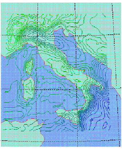
Finally, the ITALGEO99 project to compute a geoid of centimetric
precision in Italy started. The target is to obtain precise geoid undulation
in the Italian area trying also to revise the remove-restore procedure.
The last global geopotential model EGM96, a revised DTM, an updated gravity
data base and surface density information are considered to reach this
goal. Besides, the remove-restore procedure will be carefully reconsidered,
both theoretically and numerically.