International cooperation in Antarctic Geodesy is principally coordinated by the Scientific Committee on Antarctic Research (SCAR) through its Working group on Geodesy and Geographic Information (WG-GGI). Membership consists of representatives of all SCAR Antarctic nations and the WG-GGI has two programs :
| Geographic Information | |
| Geodesy |
| Increase in number of permanent GPS sites transmitting data back by satellite and submitting this data to the IGS. | |
| Adoption of ITRF and GRS80 as reference standards | |
| Continued epoch campaigns for geodynamics and to densify the ITRF | |
| Establishment of Absolute gravity stations | |
| Re activation of VLVBI facilities at Syowa | |
| Installation of several new tide gauges | |
| Technological developments in support of continuous GPS tracking at remote sites |

| 4-ID | Station name | Station owner |
|
|
|
|
99 |
| ARCT | Arctowski | Poland |
|
||||
| ART1 | Base Artigas | Uruguay |
|
|
|
|
|
| BEL1 | Belgrano | Argentina |
|
||||
| BELG | Belgrano | Argentina |
|
||||
| CUR1 | Curitiba | Brazil |
|
|
|||
| DAL1 | Jubany/ Dallmann | Argentina/ Germany |
|
|
|
|
|
| DALL | Jubany/ Dallmann | Argentina/Germany |
|
|
|||
| DUM1 | Dumont d'Urville | France |
|
|
|||
| ELE1 | Elephant/Gibbs Islands | U.K. |
|
|
|||
| ESP1 | Esperanza | Argentina |
|
|
|
||
| FAL1 | Falkland | U.K. |
|
|
|||
| FOR1 | Forster | Germany |
|
|
|||
| FOR2 | Forster | Germany |
|
||||
| FOS1 | Fossil Bluff | U.K. |
|
|
|
||
| GOUG | Gough Island | South Africa |
|
|
|||
| GRW1 | Great Wall | China |
|
|
|
|
|
| GRY1 | Grytviken | U.K. |
|
||||
| HAAG | Haag Nunatak | U.K. |
|
||||
| HAR1 | Hartebeesthoek | South Africa |
|
|
|
||
| KOH1 | Kliment Ohridski | Bulgaria |
|
||||
| KOTA | Kottas Berge | Germany |
|
||||
| MAR1 | Marambio | Argentina |
|
|
|
||
| MON1 | Montevideo | Uruguay |
|
|
|
|
|
| NOT1 | Notter Point |
|
|
||||
| OHG1 | O'Higgins | Chile/Germany |
|
|
|
|
|
| PAL1 | Palmer | U.S.A. |
|
|
|
||
| PALM | Palmer | U.S.A. |
|
|
|||
| PET1 | Peter I |
|
|||||
| PRA1 | Arturo Prat | Chile |
|
|
|
||
| PUN1 | Punta Arenas | Chile |
|
|
|
||
| RIG1 | Rio Grande | Argentina |
|
||||
| ROT1 | Rothera | U.K. |
|
|
|
||
| SAN1 | Santiago | Chile |
|
||||
| SAN2 | Santiago | Chile |
|
||||
| SIG1 | Signy | U.K. |
|
|
|||
| SMR1 | San Martin | Argentina |
|
|
|||
| SPR1 | Punta Spring | Chile |
|
|
|||
| SYO1 | Syowa | Japan |
|
||||
| SYOG | Syowa | Japan |
|
|
|||
| TNB1 | Terra Nova Bay | Italy |
|
|
|||
| TROL | Troll | Norway |
|
||||
| VER1 | Vernadsky | Ukraine |
|
||||
| VESL | Sanae | South Africa |
|
|
|||
| WASA | Wasa | Sweden |
|
||||
| ZSS4 | Zhong Shang | China |
|
|
|
The current situation with the establishment of continuous GPS installations is shown below as Figure 2
Remotely operating sites
Currently the technology available to support remotely operating sites is being extended with aim of being able to utilise continuous observations at remote sites across Antarctic to better study the surface geodynamics of the Antarctic crustal blocks. Researchers asssociated with JPL have trial sites operating in the Transantarctic Mountains, Marie Bryd Land and MacRobertson land. Although continuous GPS receivers have traditionally been used only at manned stations or short (attended) epoch occupations in the summer campaigns. Remotely operating sites have not been able to be deployed during the Antarctic winter, due to problems with power and data transmissions at unattended sites.
THE GEODETIC INFRASTRUCTURE OF ANTARCTICA (GIANT) PROGRAM
Background
At the XXII SCAR meeting in 1992, a proposal for a Geodetic infrastructure of Antarctica (GIANT) program was endorsed. The objective was to establish a precise network of points on rock sites across Antarctica, connected by space geodesy techniques, which would enable existing data based on local geodetic datums to be directly related to produce a common geographical spatial database of compatible scientific information. This geodetic infrastructure will enable earth science investigators involved in individual disciplines (such as geodynamics, oceanography, geophysics, glaciology and geodesy.) to monitor temporal changes in horizontal and vertical positions, including sea level, relative to a fixed geocentric reference system which is traceable over a period of decades. The geodetic network will provide the spatial framework for use by scientists based on rock sites and as a reference platform for moving ice cap studies. This undertaking was collectively identified as the Geodetic Infrastructure for Antarctica (GIANT) program. The program has been reviewed every two years the latest being during the XXV SCAR meeting in Concepion in 1998
The GIANT program objectives are to:
| Provide a common geographic reference system for all Antarctic scientists and operators. | |
| Contribute to global geodesy for the study of the physical processes of the earth and the maintenance of the precise terrestrial reference frame | |
| Provide information for monitoring the horizontal and vertical motion of the Antarctic. |
Key activities:
| Collaborate with other SCAR scientists to identify requirements for space geodetic sites In conjunction with SCAR working groups design an extended network of continuous geodetic observatories; |
| for manned stations |
| for remote locations | |
| Support continuation of O'Higgins VLBI for scientific purposes and as an important contribution to the global reference frame | |
| Establish priorities for on-line satellite data retrieval from ground stations | |
| Deliver regular space geodesy solutions to IGS and IERS | |
| Post details of all permanent sites on web site | |
| Develop and publish GPS base station specifications | |
| Evaluate accurate local ties between collocated techniques |
| Facilitate tide gauge data to Southern Ocean Sea Level Centre |
Key activities:
| Establish guidelines for ground mark monuments | |
| Co-ordinate annual epoch campaigns | |
| Arrange orderly data archive and data access from these campaigns | |
| Undertake GPS connections to Tide gauge benchmarks | |
| Deliver results to ITRF in conjunction with results from permanent observatories | |
| Notify results of each campaigns occupations |
Key activities:
| The collation of extensive data holdings related to topography, bathymetry and gravity as essential inputs to Geoid computation, includes: | |
| Data collection and analysis of gravity related data ground/airborne/satellite data. | |
| Collect relevant data from satellite altimetry | |
| Collaboration with International Geoid Service (IGES) and International association of Geodesy (IAG) | |
| Collaboration with SCAR WGs Solid Earth Geophysics, Geology, Glaciology | |
| Collaboration with BEDMAP, ADGRAV, RAMP as data for Geoid computation | |
| Participate in the ADMAP meeting and Earth Science in Antarctic, NZ, in 1999 | |
| Preparing data base of information from collated information prior to computation | |
| Evaluation of EGM96 improvement over OSU91 in Antarctica | |
| Facilitate computation of improved tidal models | |
| Prepare for computation of high resolution Geoid model |
Goal: Evaluate the benefit of GLONASS for global geodesy, Antarctic geodesy and navigation applications in Antarctica.
Key activities:
| Participate in the International GLONASS Experiment (IGES) pilot project with dual frequency GLONASS instruments at IGS collocated sites | |
| Retrieve data by satellite for analysis | |
| Analyse GLONASS orbits, reference frame differences and ground positions for geodesy and navigation applications in Antarctica | |
| Participate in presentation of IGEX results 1999 | |
| Report on use of GLONASS for Antarctic Geodesy and navigation. |
Key activities:
| Identify global standards for use in marine DGPS transmission using Geodetic base stations | |
| Develop options for base station sites for shipping navigation coverage of Antarctic Peninsula. | |
| Examine DGPS for real time kinematics and aviation applications in Antarctica and combination with geodetic accuracy base stations | |
| Liaison with COMNAP regarding transmission of GPS corrections at base stations. |
Key activities:
| Monitor and report on use of solar, wind and other methods of power generation for data logging information at remote GPS sites | |
| Monitor developments for remote retrieval of GPS data from remote sites by satellite communication techniques | |
| Collaboration with non-SCAR researchers |
Key activities:
| Prepare general papers on GIANT activities for publication. | |
| Ensure ready access to data from permanent observatories from host databases | |
| Establish cross links from WG-GGI web site to individual geodetic sites | |
| Develop DIFs for geodetic data in conjunction with JCADM | |
| Establish newsletter/newsgroup communication for information distribution on Web | |
| Monitor web posting of photo identifications on web sites | |
| Continue interaction with representatives on SCAR working Groups | |
| Develop IAG Commission X sub Commission on Antarctic Geodetic networks | |
| Publish WGS84-ITRF information paper and circulate within SCAR (SCAR Bulletin) | |
| Arrange an Antarctic Geodesy Symposium (AGS99) in Europe at the time of IUGG 1999. |
The WG-GGI normally meets every two years during the SCAR meetings. An inter-period Geodesy symposium or GIANT business meeting is usually held to report on progress. In the period 1995-99 work has continued in all program. The WG-GGI website (www.scar-ggi.org.au/geodesy/giant.htm) has been populated with details of the current status of Antarctic Geodetic observatories for :
| Continuous GPS installations | |
| Permanent Tide Gauge installations | |
| Absolute gravity fundamental sites | |
| DORIS sites | |
| VLBI sites |

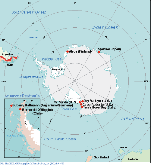
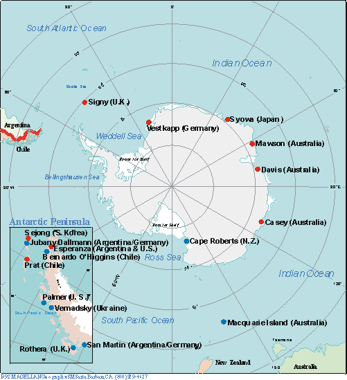
Figure 3: Tide Gauges Figure 4: Absolute gravity sites
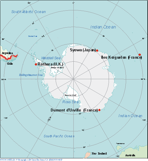
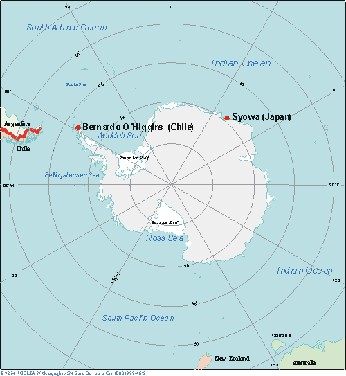
Figure 5: VLBI sites Figure 6: DORIS sites
The current activities of GIANT can be summarised as:
Permanent sites
Antarctica is important in a global geodesy sense. Global Geodesy models have heavily relied on observations from Northern Hemisphere sites and the results do not always fit in the Southern Hemisphere or represent the best global picture. Antarctic geodetic observatories provide data to rectify this imbalance with some continuous GPS sites using satellite data retrieval systems to make their data available to the IGS database. Data is available from other sites only by annual manual downloads. The status of the permanent observatories is shown in figure 2.
Epoch campaigns
Germany coordinated the GPS Epoch campaigns for the past five years of summer epoch campaigns 1995 to 1999. The objective has been to densify the ITRF beyond the fiducial network of permanent GPS stations. Details of the 1995 campaign are given in Dietrich et al (1996) and the sites occupied that time are shown in Figure1 above. The complete list to sites occupied during the five-year period is summarised in Table 1. Data is available through University of Dresden (Dietrich@ipg.geo.tu-dresden.de)
Geoids
An accurate definition of the geoid is severely constrained in Antarctica by the lack of gravity information, especially across the inland of the continent. Australia produced early versions of the Antarctic Geoid based on GEM and OSU gravity data sets, which are available on the AUSLIG web site http://www.auslig.gov.au/geodesy/antarc/antgeoid.htm. The current situation with the geoid in Antarctica remains hampered by the continuing lack of ground gravity data.
A grid of geoid separation values initially from the OSU91A geopotential model and subsequently from the recent EGM96 are available on the AUSLIG webs site for individual interpolation for any location south of 60 degrees latitude
This enables GPS users to refer their observed elevations (ellipsoidal values) to a nominal sea level surface, although the N values are limited by the amount of data in the Antarctic region
The gathering of geophysical data to improve the Antarctic Geoid is a major undertaking and data collection is being undertaken cooperatively with other groups through the newly formed SCAR Neo Antarctic Group of Specialists (ANTEC) and the BEDMAP, ADGRAV and RAMP projects.
GLONASS
GLONASS observations were undertaken in collocation with GPS at McMurdo in January /February 1999. A results seminar will be held as part of ION 99 conference in Nashville in September. A report on Antarctic applications will be prepared following this seminar.
DGPS applications
The current DGPS de facto standard for base stations is that used by the United States Coastguard for its base stations. These base stations specifications are recommended for use in the GIANT Program. Details are available on the web site (www.navcen.uscg.mil/dgps/dgeninfo/dgpsant.htm). The WG-GGI has investigated the establishment of DGPS transmission base stations along the Antarctic Peninsula. With three well distributed sites DGPS accuracies of better than two metre would be available to all shipping along the Eastern side of the Peninsula a significant safety measure. The recommended sites are:
| King George Island | |
| Palmer | |
| San Martin or Rothera |
Remotely operating GPS sites
At present there is a technological limitation on operating and maintaining remote placed continuous GPS equipment which need to be to be self powered and able to transmit data back to manned bases or directly by satellite to global data centres. Technological developments are continuing and ANTEC has arranged a special seminar at Pasadena USA in August 1999 to discuss the state of the technology for remote power and data transmissions for remote GPS sites.
Antarctic research symposia
There have been a number of recent Antarctic Geodesy events held including:
| IAG Scientific Assembly Rio 1997 | |
| Antarctic Geodesy Symposium98 Santiago July 1998 | |
| AGU San Francisco December 1998 | |
| EUG10 Strasbourg March 1999 | |
| EGS 99 The Hague April 1999 |
GROUP OF SPECIALISTS ON ANTARCTIC NEOTECTONICS (ANTEC)
At the SCAR XXV meeting in Concepcion, Chile, Prof. Dalziel, IUGS Delegate, presented to Delegates a joint recommendation from the Working Groups on Geology, on Solid-Earth Geophysics, and on Geodesy and Geographic Information, that SCAR should establish a new Group of Specialists on Antarctic Neotectonics (ANTEC). The presentation highlighted some unique aspects of the Antarctic continent such as:
| It lies at the centre of a lithospheric plate that, unlike any other, is almost entirely surrounded by spreading ridges and, furthermore, has been essentially in a polar position for the last 100 million years; | |
| It appears to lack the intra-plate seismicity that characterises all other continents; | |
| It includes at least one intra-plate rift system, stretching from the Ross Sea to the Weddell Sea, that has unique characteristics including possible implications for the stability of the West Antarctic Ice Sheet.; and | |
| It is covered by the only extant continent-scale ice sheet, which applies unusual stresses to the crust. |
| Member |
|
|
|
| Dr Terry J Wilson (Convenor) | USA | Tectonics | wilson.43@osu.edu |
| Dr Robin E Bell | USA | Gravity, Geology | robinb@ldeo.columbia.edu |
| Dr Alessandro Capra | Italy | Geodesy, Gravity | alessandro.capra@mail.ing.unibo.it |
| Dr Reinhard Dietrich | Germany | Geodesy | dietrich@ipg.geo.tu-dresden.de |
| Dr Jesus M Ibañez | Spain | Seismology | ibanez@iag.ugr.es |
| Dr Tom S James | Canada | Glacial rebound | james@pgc.nrcan.gc.ca |
| Mr John Manning | Australia | Geodesy, Remote sensing | johnmanning@auslig.gov.au |
| Dr Andrea Morelli | Italy | Seismology | morelli@ingrm.it |
COLLOCATION WITH OTHER GEODETIC TECHNIQUES
GPS is a major geodetic technique in use in Antarctica but for global observations collocation with other techniques is also important such as DORIS, Absolute Gravity, Tide Gauges, and VLBI.
The first Antarctic VLBI experiment was observed at Syowa in 1991 using a temporary configuration. A permanent installation was established by Germany at the Chilean base of O'Higgins in 1993 and has participated in a number of Southern Hemisphere campaigns. Japan refurbished the antenna at Syowa as a permanent installation in 1998 and experiments between other sites in Australia and South Africa are continuing, whilst O’Higgins continues to be operated during the summer months.
Additionally the USA have established a precise epoch based observation network as part of a geophysical research to study the deformation in the McMurdo region in the TAMDEF project. This network has been observed on a campaign basis for three years.
A super conducting Gravimeter has been in operation for four years at Syowa. To date Satellite Laser Ranging has not been undertaken in Antarctica but is being considered.
SUMMARY
Internationally coordinated Geodesy activities continue in Antarctic despite the problem with logistic associated with such a remote region. The lack of gravity remains a pressing concern requiring extensive aerogravity work and integration with forthcoming satellite gravity missions. The SCAR WG-GGI is an active ongoing group and geodetic activities are promoted and coordinated through the SCAR GIANT program. A new SCAR Group of Specialists on Neotectonics has been established to integrate the work of Geologists, Geophysicists and Geodesists in Antarctica
John Manning
Reinhard Dietrich
Co Chairs
Antarctic Sub Commission of Commission X
7 July1999
Update 2002-11-01 by cct.